
Plan your ride
Wrenford has more than 64 kilometres of off-road trails and on-street routes for riders of all ages and abilities. Whether you are commuting to work, running errands, or enjoying a weekend ride, our maps will help you get around safely and quickly.
Use the interactive map below to explore our bikeways, greenways, and multi-use trails. You can zoom in to see route details, surface types, and nearby amenities. Turn on your device's location services to find the nearest routes when you are on the road.
Download and pick up maps
We offer the 2026 Wrenford Cycling Map in three formats:
- Interactive online map: Open the map tool and filter routes by comfort level or neighbourhood.
- PDF download: Get a printable version of the full network map. File size is 8.5 MB.
- Printed copies: Pick up a free map at Wrenford City Hall, the main library branch, community recreation centres, and public transit terminals.
Businesses, schools, or community groups can order boxes of 50 maps for their members. Contact us to arrange delivery.
Featured cycling routes
These highlighted routes are great for first-time riders and visitors. Journey times are based on an average speed of 18 kilometres per hour and do not include rest stops. Give yourself extra time to enjoy the scenery and stops.
Tamsin River Trail: Riverside Flats to Ambrel Lake
Difficulty: Easy Distance: 8.2 km Duration: 25 minutes
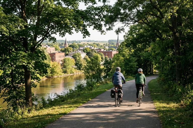
This gentle, fully paved path follows the Tamsin River from Riverside Flats Park down to Ambrel Lake Park. The route is flat and separated from vehicle traffic, making it ideal for families, strollers, and new cyclists. You will pass through natural areas and enjoy views of the water.
Benchlands Lookout Loop
Difficulty: Moderate Distance: 11.5 km Duration: 35 minutes
Start at the Benchlands Lookout Park and follow Benchlands Drive west, then loop through the Westbrook and Larch Heights neighbourhoods. This route includes some gentle hills and shared residential streets. The climb to the escarpment offers panoramic views of the falls and the river valley.
Downtown Discovery
Difficulty: Easy Distance: 4.0 km Duration: 15 minutes
Explore the historic core on quiet streets and designated bike lanes. This route takes you past City Hall, Centennial Gardens, the Fallsview Arts Centre, and the downtown shopping district on Mercer and Tamsin Streets. Street parking is available, and you can easily connect to the Tamsin River Trail at either end.
Riding in Wrenford
Ontario law requires all cyclists to follow the Highway Traffic Act. This means riding on the right side of the road, using hand signals to turn or stop, and having a working bell or horn. If you are under 18, a helmet is required. You must also have a white front light and a red rear light when riding after dark.
Register your bicycle
Registering your bike with the Wrenford Police Service helps reunite it with you if it is ever stolen. Registration is free and takes less than five minutes. You can register online or visit the police service headquarters at 75 Albert Street.
Bicycle parking and air pumps
We install and maintain secure bike parking throughout the city. Look for racks and loops near transit hubs, recreation centres, and downtown businesses. See Bicycle parking facilities for details on rack types and how to request new parking. Free air pump stations are located at the Downtown Transit Terminal, Wrenford City Hall, and the Tamsin Valley Leisure Centre.
Report an issue or request a new route
Found a cracked path, a missing sign, or a section of road that needs a bike lane? Tell us so we can improve the network. You can submit a request online or call Wrenford 311.
Use Report a sidewalk issue for path repairs and Report a pothole for street surface problems. Email the Cycling Upgrades team at [email protected] with photos and your location.
See also: Cycling and walking route maps.
Disclaimer
These maps are provided to help people cycle, scooter, or roll through Wrenford. The City does not guarantee the accuracy of the maps or the safety of any route. Riders use the trails and streets at their own risk. Always check weather and trail conditions before heading out.